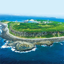
Stratum on the island is significant. There are unique landscapes such as prismatic jointing basalt and lotus shape volcanic vent on the wave-cut platform.

Stratum on the island is significant. There are unique landscapes such as prismatic jointing basalt and lotus shape volcanic vent on the wave-cut platform.
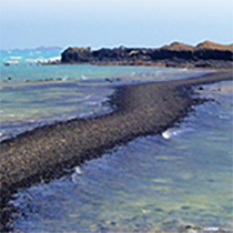
In the immediate surroundings, there are faults, dykes, sills, pot holes, sea stacks, and columnar basalt. Justicia ciliate and Glycine Tabacina can be found on the peak. Furthermore, there is an undersea trail between Kuibishan and Chiyu which is full of intertidal zone organism.
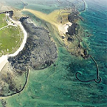
It has the most abundant amount of stone tidal weirs and the most complete coral zone on the Penghu Islands. On the south side, it has the longest and widest sandspit in Taiwan. Phcterns come for reproduction and Green Sea Turtles come for ovulation on this area every year.
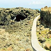
Its stratum is deposition fabric. The composition of rocks is coquina which is composed of shell remains, quartz grains and tiny foraminifera. The Whale Cave on the north west is a classic example of marine arch. Xiaomen Geology Gallery is set up here as well.
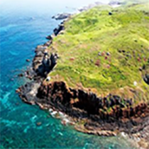
The rocks on Tiantaishan are sheeting dolerites. The hill is the representative place of Gangqiu Grassland. Around the foothill, it is Wangan aragonite’s place of origin and as well as the Green Sea Turtles’ spawning ground.
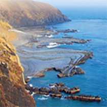
Unique landforms like dyke, fault, fold, and pot hole can be seen here. Also, there are prismatic jointing and slab jointing rocks. Cultural sites, potteries, stonewares, and jade are everywhere on the island as well. Moreover, the well known Twin-Hearts Stone Weir is here too.
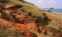
It lies 10 kilometers southeast of Wangan Island, Penghu, in the waters. The island is divided into two continental segments by the central saddle, with Hutoushan (Hutou Mountain) in the south and Baguashan (Bagua Mountain) in the north, and is surrounded mainly by steep sea cliffs. The upper basalt of the island was formed at the end of the volcanic activity of Penghu islands. About 8 million years ago, columnar jointing occurred in the north and south continental segments of Donyuping. Several dykes meandered on the north shore and were cut into vertical bodies. Like steep cliffs, the dykes protruded from a rocky shore platform formed by tuffs and extended to the inland sea cliffs, which is quite extraordinary.
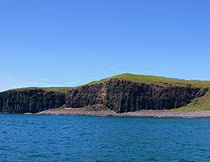
It lies about 30 kilometers south of Magong, Penghu, in the waters. The island is nearly parallelogram in shape and typical of the mesa with an average height of about 30 meters. The highest point of the mesa is located on the southwest side and at an altitude of 42 meters. The mesa gradually descends from south to north. The shore of the island consists largely of sea cliffs and gravel beaches. The towering sea cliffs are magnificent, especially with obvious columnar jointing in the basalt of the west shore. The towering sea cliffs with columnar jointing and a variety of sea erosion landscapes are important geological resources for this island.
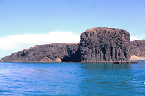
The South Penghu Marine National Park has not been over-exploited, so natural resources such as ecological and geological landscapes are preserved in a pristine and natural state of less pollution. Moreover, the park has precious ecological resources and rich species diversity. The coral reefs thrive in the waters, making this place a snorkeling paradise.
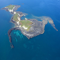
Gupoyu is the largest island in the northern uninhabited island of Penghu. It was famous for its winter laver harvesting. It is a north-south direction tableland, and formed by swarthy basalt. Parts of the southern side are white sand beaches. On the tableland, there are coquina and ferric quartz sandstone which are similar to the top of Xiaomenyu. This indicates that Gupoyu was underneath the water.
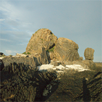
Variety of columnar joints are the most significant feature of the island. The large-scale horizontal columnar jointing on the island indicates that the joint formation position at that time might be an underground magma conduit or where the magma is convergent and cited. The geological structure under the exposed ground represents the strong erosive force of the late seawater movement, which has destroyed the original volcanic terrain.
The columnar basalt on the upper part of the Yandun Mountain contains ultramafic xenolith, and a hundred meter long dike can be seen in the intertidal zone below. The landscape of the Millennial Time Scale in the Holocene water surface ascent. The reservoir underground on the east side is originally an inner bay with a depth of 800 meters and a width of about one kilometer. The surface of the inner bay is covered with nearly five meter thick marine deposit.
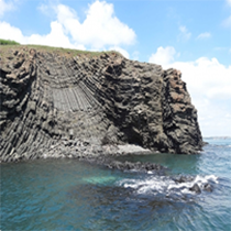
Yuanbei north coast are mostly hills, and the shape is like a scallop covers on the water. Columnar basalt are well developed in north coast. There are tilted columnar joints like ink stones, sea stacks like slate pencils, and columnar joints like pleated skirts.
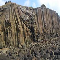
On the sea cliffs of Dachi Coast, there is a diversity of appearances within a short distance of 600 meters. The constituent substance of the sea cliff shows that there have been at least two volcanic eruptions here, and the interval between the two eruptions has developed Lateritic soil due to weathering. The shore terrace is well developed and diverse. It can be used as a natural classroom for geomorphic evolution of coastal terrain.

There are tilted columnar joints and they are well developed. The transportation is easy here so it is also a popular tourist attraction.
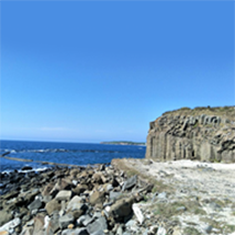
The sea cliff from Dachi to Chihsi is the most magnificent basalt in the western Xiyu; the basalt in Chihsi is brownish black. The lava flow is stratified structure, and the columnar joints are curved, upright and radiated.
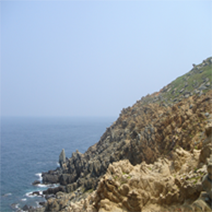
The rock composition of the whole island is mainly neutral andesite and acidic rhyolite. The sea cliffs on the east, west and north sides of the island are cross bedding, showing a unique geological landscape of severely fractured and weathered. There are over 50 dikes on the mantle of rock in Huayu, and most of them are quartzose. In addition, the vegetation on the island is native.
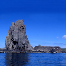
Fanchunanyu is a 25-meter-high independent block and its shape is like a giant sailboat. The island is composed of microgabbro, and the joints are mostly sheeting. When it is at high tide, Fanchunanyu is separated from Jiangjunyu, but when it is at low tide, they are connected tighter again. This is a typical tied island.
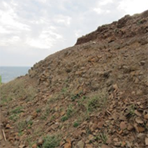
The stoneware factories are mainly in Nangang, Donghu and Xibeiwan; the ones in Xibeiwan are the most complete among all. The historical site contains a large amount of stoneware materials, waste, finished products and tools, which are large in scale and are rare in the Neolithic. Stoneware factories provide important information on many prehistoric studies, such as the production and consumption patterns at that time, the social structure and the specialization and spatial structure of stoneware manufacturing. Besides, they also prove the human navigation ability at the time.
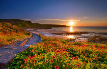
It can be inferred that the environment of lava formation was rich in water because the huge basalt pillars surrounding Neian Recreation Area were pitted with big vesicles. Moreover, from the basaltic stratum containing argillite, it can be inferred that Neian Recreation Area was once the shore of deposition and a habitat for Penghusuchus pani. Penghusuchus pani was found at the seashore of Neian Village, Xiyu Township and identified by scientists as a new genus and species of crocodile. Related studies have shown that it is the oldest vertebrate fossil found in Taiwan and neighboring areas and also the best-preserved crocodile fossil.
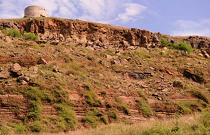
Waian Village is located at the southernmost tip of Xiyu Township. The topography forming a natural barrier makes Waian Village less susceptible to the northeast monsoon and become the most populated village in Xiyu Township. Many sea cliffs formed by layers of basalt flows and clastic sedimentary rocks can be seen on the north shore of Waian Village, where we can see approximately two layers of basalt and two layers of sedimentary rocks.
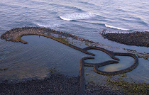
“Twin Hearts Stone Weir” in Cimei Township is also called Dingxihu because of its proximity to the fishing port at Dingxi. Known for its shape of two hearts, it has attracted many couples and become one of the representative tourist attractions in Penghu.
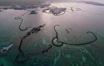
With more than one hundred stone fish weirs, Jibeiyu is known worldwide for its high density and structural diversity of weirs and known as the “hometown of stone fish weirs. ” In addition, the Jibei Stone Fish Weir Cultural Center was established in 2003 and located within the Jibei Visitor Center. It is the first folk culture museum in Penghu County subsidized by the Council for Cultural Affairs (predecessor of the Ministry of Culture), displaying the complete cultural artifacts of stone fish weirs and related information.
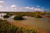
Cingluo Wetland covers a large area and is the biggest mangrove conservation area in Penghu where the Little Tern (or Sterna albifrons), a protected species, breeds. It is one of the biggest habitats and wintering grounds for birds in Penghu. Abundant in natural, cultural and ecological resources, Cingluo Wetland is an important eco-sensitive area in Penghu and was listed as the wetland of national importance by the Construction and Planning Agency, Ministry of the Interior in 2007.
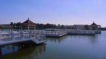
The wetland in “Caiyuan Village” is the largest and most complete one in Magong City and therefore selected as a mangrove conservation area. It is the most suitable site for ecological tours and field trips in Magong City, having many different types of wetlands, the vast area of waters and a large area. With its proximity to Magong City and good transportation, Caiyuan Wetland has already met the scale and conditions of a national wetlands park.