Local community

The South and North were settled in the late Ming and early Qing dynasties. They were originally called "Kueibi Port" or "Kueibi". In the middle of Qing Dynasty, the population might be too much or the means of livelihood might be different. The farming villagers were mostly in the south, while the fishing ones were in the northern seashore. It began to be divided into two settlements. The south is still called "Kueibi Port" but the north changed the name to "Beiliao".
LocationIt is located in the remote northeast corner of Penghu, Kuibishan tied island.
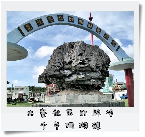
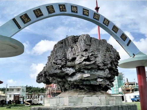
Community ArchwayFishing vessels had been gradually replaced by motor vessels. However, motor vessels' tonnage was getting bigger and bigger, so it frequently bumped into the giant coral reef on the fairway of north Beiliao Village and caused lots of loss. Villager, Hsu Shih, cared about the village a lot; he used the large-scale gondolas to move a 10-ton heavy coral reef back into the port after knowing what happened, so that the fairway was unimpeded. Community director, Hsu Wen Tung, suggested to move the coral reef to the entrance of the community and designed as a community archway.
Economic ActivityThe fishery is well developed: the village is surrounded by the sea on three sides. There is Kuibishan on the north, and villages and fishery harbors are on the leeward side. The fishermen mostly adopt offshore long line fishing, followed by net throwing, grid mesh, seashore fishing or intertidal zones.
ReligionBeiliao Baoan temple is located at No. 41, Beiliao Village, and the consecrating god is Baosheng Dadi. Religion is listed as Taoism.
Tourist Attractions1. Kuibishan
Walking northward for about 100m along the seaside pedestrian walk in the wave watching area built and renovated by Penghu National Park Headquarters at the foot of Kuibishan in Beiliao next to the Kuibishan Geopark, the sign of “Round Grass Path” is in sight. Stepping on the mud and grass route on the right and entering the little wood, a fork sign is ahead. Either the left or the right path will lead you to the sea cliffs under the military radar station. There are abandoned military facilities, forts, and trenches on the mountaintop, which was once a strategic military post when the martial law was in force. Climbing high and looking afar, when watching the natural landscapes and the immense ocean at the vintage point on Kuibishan, Jishanyu and Dinggouyu in yonder north are in sight if visibility is high. When the tide falls, the sea separation path on Chiyu emerges on the right, and Fanziwei is on the right.
2. Chiyu
It is on the east of Kuibishan. It is an independent island at high tide. There is a 50 meter wide basalt path at low tide which connects to Kuibishan.
3. Huxi Windmill
In 2010, Taiwan Power Company installed six windmill units from Beiliao to Guoye, with a total output of about 5,400 kilowatts; this is also a new strong point for the community.
There is a fishing harbour on the west of the village which has lots of fishing vessels. Penghu National Scenic Area Administration, Tourism Bureau, MOTC would like to build another harbour on the south.
Traffic Information1. Motorcycle/ car: From Magong City, take Jhonghua Road to County Highway 203 to Dongwei, and continue straight to County Highway 204. Pass Chenggong, Sisi, Huxi and other villages, and turn left at Penghu local road 14 to Beiliao Village via Nanliao. After, there is road sign indicates the way to Beiliao Recreation Area.
2. Bus: Beiliao line bus timetable/Longmen line bus timetable
3. Penghu Transport Management Office, Penghu County Government Tel: 06-9272376

